

Selfadhesive vinyl geodesy, geodesy on film, geodesy on adhesive film
FILTER RESULTS
Image orientation: all
horizontal
vertical
square
Filetype: all
photo
illustration
vector
Apply
#297141925
 Vector landscape geodesy topography map background. Line texture pattern.
#268869272
 engineer site survey with laser tripod machine in site construction background
#167239411
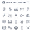 Geodetic survey engineering vector flat line icons. Geodesy equipment, tacheometer, theodolite,...
#157114730
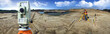
 Surveyor’s telescope at new road construction site
#80027616
 geodesy concept with pencil and calipers
#709850177
 survey engineer in construction site use theodolite mark a concrete pile co ordinate
#35219144
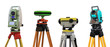
 surveyor equipment outdoors
#27828228
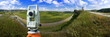
 Theodolite survey outdoors with geodesist
#39840190
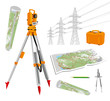
 Devices for a geodesy
#169737557
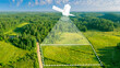
 The drone with the professional camera takes pictures of the misty mountains at sunset
#540463599
 Surveyor engineer stands at the geodetic instrument. Geodetic and cadastral works
#532886149
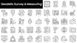 Set of outline geodetic survey and measuring icons. Minimalist thin linear web icon set. vector...
#116864453
 Surveying instruments - theodolite with maps and compasses, pencil, power lines. Isolated vector set...
#253515360
 Special device (level) for surveyor builders, geodesy equipment close up. Outdoors, copy space.
#667633722
 Civil engineer inspecting road construction work and supervising expressway project
#41468396
 engineering instrument and construction industry
#485901002
 Digital elevation model. GIS product made after proccesing aerial pictures. It shows excavation site...
#100544288
 silhouette black man survey and civil engineer stand on ground w
#460797509
 Imaginary cadastral map of territory with buildings and roads drawn with a CAD...
#600398131
 Satellite above earth. Topographic surveys from space. Satellite geodetic research. Creation of...
#297141966
 Vector landscape geodesy topography map background. Line texture pattern.
#172653295
 Picture of construction engineer working on building site
#578388395
 Topographic map background geographic line map with elevation assignments. Modern design with White...
#682218191
 Topographic map background illustration of island hand drawn. Contour background design element thin...
#617898109
 Topographic map. Geographic contour map background. Vector illustration.
#259413477
 Surveyor on green field
#79727247
 surveyor equipment theodolie outdoors
#27725839
 Theodolite measurement instrument outdoors
#624068636
 Surveyor builder Engineer with theodolite transit equipment at construction site outdoors during...
#241733442
 Engineer surveyor working with theodolite at construction site
#224732561
 Geodesic device and wind rose
#37078355
 Architecture plans
add to favorites