

FILTER RESULTS
Image orientation: all
horizontal
vertical
square
Filetype: all
photo
illustration
vector
Apply
#169474649
 Amazon Rainforest in Brazil
#113451807
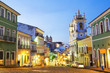
 Aerial view of Salvador da Bahia cityscape, Bahia, Brazil.
#85804339
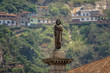
 三権広場 目隠し裁判の像
#14796347
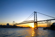 Bridge at Sunset
#42485882
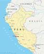 Peru political map with capital Lima, national borders, most important cities, rivers and lakes....
#98685290
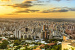 Panoramic view of golden sunset in city Belo Horizonte , Brazil .
#174770379
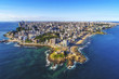
 Aerial view of Curitiba City at sunset - Curitiba, Parana, Brazil
#95824301
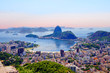
 Aerial view of Christ the Redeemer and Rio de Janeiro city
#146901328
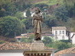
 Tiradentes Statue in Tiradentes Square - Ouro Preto, Minas Gerais, Brazil
#222063076
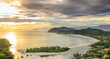
 Jericoacoara is a virgin beach hidden behind the dunes of the west coast of Jijoca de Jericoacoara,...
#102318411
 Brazil Landmark skyline. Vector illustration
#110513601
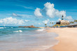 Barra Beach in Salvador de Bahia Brazil
#187741404
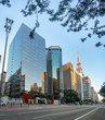 Paulista Avenue - Sao Paulo, Brazil
#3412866
 estátua de tiradentes - ouro preto - mg
#86577423
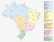 Brazil, administrative and territorial division map
#4534989
 Fortaleza
#111752406
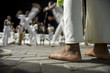 Brazilian capoeira group performing at night in Salvador, Bahia, Brazil
#95033323
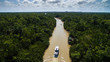 Aerial View of Amazon River in Belem do Para, Brazil
#174773487
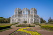 Greenhouse of Curitiba Botanical Garden - Curitiba, Parana, Brazil
#220664624
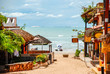
 Streets of Colonial Paraty
#66584553
 Pelourinho in Salvador de Bahia, Brazil
#97061468
 Sao Paulo skyline from Parque Ibirapuera park
#38838496
 Main air routes in South America
#192633675
 Spectacular sunset on the Barra do Una beach on the coast of the state of Sao Paulo , Brazil
#111502867
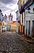
 Colourful colonial houses at the historical district of Pelourinho in Salvador, Bahia, Brazil.
#238728101
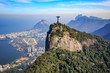
 Rio de Janeiro. Brazil. View of the city from mount Corcovado. Corcovado mountain offers magnificent...
#85804280
 ブラジリアの国会議事堂
#97067005
 Paulista Avenue
#68957983
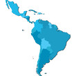 america latina
#170794620
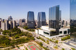 Aerial View of Itaim Bibi in Sao Paulo, Brazil
#91449318
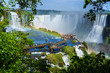 Tourists at Iguazu Falls, on the border of Brazil, Argentina, and Paraguay.
#57721500
 Three-dimensional map of Brazil.
add to favorites