

Glass state, state glass tiles, state glass panel, state print on glass
FILTER RESULTS
Image orientation: all
horizontal
vertical
square
Filetype: all
photo
illustration
vector
Apply
#104357830
 Virginia black map on white background vector
#212104154
 Outline map of the United States of America. 50 States of the USA. US map with state borders....
#361462051
 Set of USA states labels
#378732459
 Doodle vector map of New Jersey state of USA
#354840465
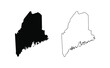 Maine state silhouette, line style. America illustration, American vector outline isolated on white...
#286702256
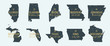 Set 3 of 5 Highly detailed vector silhouettes of USA state maps with names and territory nicknames
#44530041
 NEW YORK CITY - MARCH 12: The Empire State Building shines in th
#586690326
 New York state map contour. New York state map. Glyph and outline New York map. US state map.
#671766177
 Front view of facade of the Capitol building in the state of Minnesota in Saint Paul, MN
#475893329
 Idaho state map travel logo
#509733267
 The state capitol building in Sacramento, California
#423371643
 Florida state isolated on a white background, USA map
#341271035
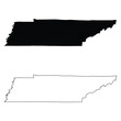
 Tennessee Map Black | State Border | United States | US America | Transparent Isolated | Variations
#143171224
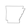 map of the U.S. state Arkansas
#296860448
 The state banner of Maryland the old line state vintage illustration
#227085584
 North Carolina - map state of USA
#79421018
 Lupine in sunset at Columbia hills state park, Washington
#475122871
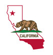 california ca state flag in map shape
#627221270
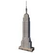 empire state building
#354541613
 Tennessee TN state Map USA. Black silhouette and outline isolated maps on a white background. EPS...
#104279735
 Tennessee black map on white background vector
#316376951
 Vector of nice Alaska state flag.
#398916567
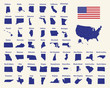
 Linear map of USA. United States of America concept map. State maps. Vector illustration
#361352521
 Doodle vector map of Maryland state of USA.
#354840548
 Missouri state silhouette, line style. America illustration, American vector outline isolated on...
#444024841
 Mississippi State Capitol in Jackson, Mississippi, USA
#414699135
 Texas icon set. texas sign symbol
#586690342
 Florida map contour. Florida state map. Glyph and outline Florida map. US state map. Sarasota...
#551898115
 Silhouette of Louisiana state border
#105171408
 set of US states maps
#696643154
 Indiana state map. Map of the U.S. state of Indiana.
#423371455
 Virginia state isolated on a white background, USA map
add to favorites