

Picture on glass, author martinova4
FILTER RESULTS
Image orientation: all
horizontal
vertical
square
Filetype: all
photo
illustration
vector
Apply
#482189384
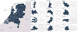 Vector color detailed map of Netherlands with the administrative divisions of the country, each...
#483809215
 Vector color detailed map of Poland with administrative divisions of the country, each provinces...
#309904559
 3d silhouette of a global world map, sphere with continents and islands of the world monochrome...
#404559164
 Beige adhesive tape, set of crumpled torn pieces of sticky brown tape on white background
#471890626
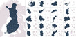 Vector color detailed map of Finland with administrative divisions of the country, each region is...
#523383217
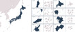 Vector detailed map Japan with the administrative divisions of the country, each region is presented...
#495270502
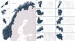 Vector color detailed map of Norway with the administrative divisions of the country, each Counties...
#309904592
 Detailed global world map, with borders and names of countries, seas and oceans, vector illustration
#455740683
 Vector color detailed map of Italy with administrative divisions of the country, each region is...
#434176432
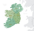 Detailed map of Ireland with administrative divisions into provinces and counties, major cities of...
#614890944
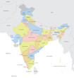 Detailed map of India with administrative divisions and borders of neighboring countries, vector...
#632331356
 Set with beautiful branches, leaves and flower buds on white background
#399608475
 Detailed vector blue map of Germany with administrative divisions into lands and regions of the...
#411869919
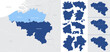 Detailed, vector, blue map of Belgium with administrative divisions into regions country
#530608693
 Set of yellow oil paint brush strokes, high detail abstract acrylic grunge elements, texture...
#673090966
 Frame of medicinal herbs, leaves and flowers, bottles of essential essential oils on white...
#482359376
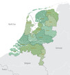 Detailed map of Netherlands with administrative divisions into Provinces and Municipalities, major...
#528281865
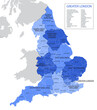 Vector, blue map of England with division into regions, counties and districts
#471890627
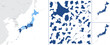 Detailed vector blue map of Japan with administrative divisions into regions and prefectures of the...
#455740690
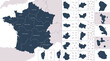 Vector color detailed map of metropolis and overseas territories of France with administrative...
#432907532
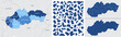 Detailed, vector, blue map of Slovakia with administrative divisions country
#414133708
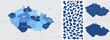 Detailed, vector, blue map of Czech Republic with administrative divisions into regions country
#517952881
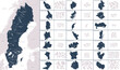 Vector color detailed map of Sweden with the administrative divisions of the country, each Regions...
#493640863
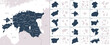 Vector color detailed map of Estonia with the administrative divisions of the country, each...
#420455921
 Detailed, vector, blue map of Denmark with administrative divisions into regions country
#482173175
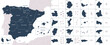 Vector color detailed map of Spain with the administrative divisions of the country, each Autonomous...
#442114794
 Detailed global world map, with borders and names of countries, seas and oceans, Continent of South...
#391241086
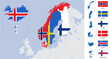 Vector detailed map and flags of Scandinavia with country silhouettes Sweden, Norway, Denmark,...
#442114883
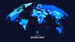 Detailed colorful global world map, with borders and names of countries, seas and oceans, vector...
#483809213
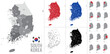 Detailed vector map of regions of South Korea with flag
#385008518
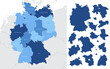
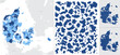
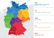 Vector map of regions of Germany
#309904629
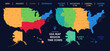 Detailed map of US regions and time zones, Colorful infographics of the United States of America,...
add to favorites