

Picture maps on canvas, maps canvas, canvas maps
FILTER RESULTS
Image orientation: all
horizontal
vertical
square
Filetype: all
photo
illustration
vector
Apply
#522948660
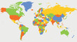 High detailed political map of World
#610865102
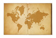 Vintage world map on an old open book
#602508035
 3d city map with 3d pointers location, gps, transport concept, generative AI
#601339861
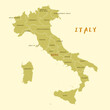 Vector map of Italy country
#578632637
 South Korea map set with gray and multicolor. PNG.
#573184094
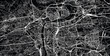
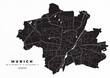 Munich map vector poster flyer
#534796400
 Highly detailed Greece map with borders isolated on background
#527222031
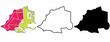 Vatican City State map icon set isolated on white background.vaticano map.vaticanae icon map
#114206829
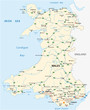 vector road map of the British territory of wales
#579330133
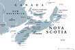 Nova Scotia, Maritime and Atlantic province of Canada, gray political map. Cape Breton Island and...
#700388020
 Sleek Iowa State Map Logo - A Crisp White Silhouette of Iowa Against a Bold Blue Background,...
#166654617
 Vector world map with dot and capital isolated on white
#114460966
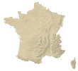 Relief map of France
#751871715
 Digital map of Asia, concept of global network and connectivity, data transfer and cyber technology,...
#434176849
 Urban vector city map of Prague, Czech Republic, Europe
#749133969
 Artistic rendering of urban development and transportation.
#233081074
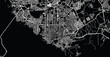
 Urban vector city map of Nagasaki, Japan
#259365178
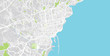
 Urban vector city map of Manaus, Brazil
#232492694
 Urban vector city map of Catania, Italy
#238760054
 Urban vector city map of Derry, Ireland
#677657393
 Cinematic view over rising planet earth from the space. Night earth background
#635857171
 World map composed of colorful block objects. created by generative AI technology.
#630622228
 A sepia-toned old world map in two circles with illustrations and a banner.
#593722224
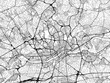 Road map of the city of Frankfurt am Main Metropole in Germany on a transparent background.
#568948504
 Digital grey color world map on the white background. Vector illustration.
#550809799
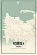 Retro US city map of Norfolk, Virginia. Vintage street map.
#543234521
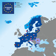 Schengen Area map with borders and flags of countries, Europe, vector illustration
#512744789
 Pin map with Trinidad and Tobago flag on world map. Vector illustration.
#507976999
 Tiny characters measure distance on the world map using a measuring tape. Travel duration. Two...
#495727938
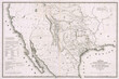 Visual illustration of the Texas annexation into the USA from Mexico on a detailed map
#493755576
 World map and coordinate pins GPS navigation system communication links 3D illustration
#479151238
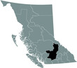 Black flat blank highlighted location map of the THOMPSON–NICOLA regional district inside gray...
add to favorites