

Acrylic mapping, mapping on plexiglass, plexi mapping
FILTER RESULTS
Image orientation: all
horizontal
vertical
square
Filetype: all
photo
illustration
vector
Apply
#335241320
 California Map Black | State Border | United States | US America | Transparent Isolated | Variations
#586015274
 High detailed vector map on a gray background. Japan map
#583747260
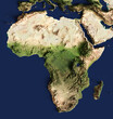 3d illustration of a highly detailed map of Africa. Elements of this image furnished by NASA.
#508326582
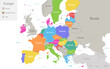 Europe with European Union and parts of Asia, multicolored map isolated on white background vector
#200298290
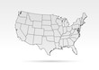 USA map grey outline shadow gradient
#629608655
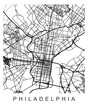 Vector design of the street map of Philadelphia against a white background
#620724420
 Infographic data visualization overlayed on mountain landscape
#563882355
 World map dotted background
#518769328
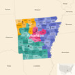 Arkansas's congressional districts (2013-2023) vector map with neighbouring states and terrotories
#512728048
 White and light grey Jersey City area vector background map, streets and water cartography...
#464680797
 Red map geo tag isolated on white. 3d rendering.
#440437370
 France map network
#421713334
 Blank map Santa Catarina of Brazil. High quality map Santa Catarina with municipalities on...
#395996801
 flat chile map infographic
#394221344
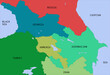 South caucasus colorfull political map
#346821214
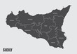 Sicily regions map with labels isolated on white background
#711349496
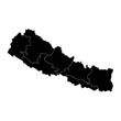 Nepal map with administrative divisions. Vector illustration.
#337672730
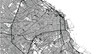
 Detailed map of Boston, MA, USA
#307450022
 Urban vector city map of Buenos Aires, Argentina
#268716561
 World map with wild animals living on various continents and in oceans. Cute cartoon mammals,...
#242847001
 Dark area map of Delhi, India
#228331382
 Pernambuco (Region of Brazil, Federated state, Federative Republic of Brazil) map vector...
#212414046
 central african republic road vector map
#196977388
 152 map icons - round
#186759403
 Map of North America
#144439346
 thin line australia map with shadow
#114806198
 Washington D.C. on a map
#96131393
 grey map of Panama
#751871315
 Digital map of Asia, concept of global network and connectivity, data transfer and cyber technology,...
#679762182
 Maine state and USA map with white states a 3D united states of america map
#131009916
 Blank map of United States of America, aka USA, divided into states in four shades of blue. Simple...
#756166812
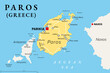 Paros, Greek island, political map. Island of Greece in the Aegean Sea, west of Naxos, and part of...
add to favorites