

Acrylic equator, equator on plexiglass, plexi equator
FILTER RESULTS
Image orientation: all
horizontal
vertical
square
Filetype: all
photo
illustration
vector
Apply
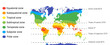
#508115998
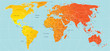
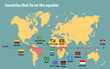 Map of all the countries that lie on the equator
#290062458
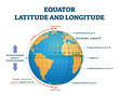 Equator latitude or longitude vector illustration. Equator line explanation
#325418109
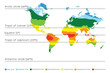 World map with climate zones, equator and tropic lines, arctic and antarctic circle. Vector...
#264422395
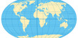
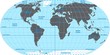 Vector map of the world. Oceans and continents on a flat projection.
#438483717
 The equator line
#346483970
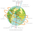
 World map with most important circles of latitudes and longitudes, showing Equator, Greenwich...
#305269518
 Sunlight, rays on surface of globe. Formation of seasons. Reasons. With the axis tilt and annual...
#6149360
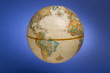 a globe of the earth against a blue background
#83328891
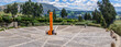
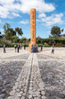
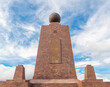
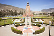
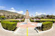 Middle of the World Monument
#25957896
 Equator
#384882739
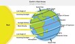
 climate zones map. Vector with equatorial, tropical, polar, temperate and sub- zones
#314034108
 Latitude and longitude diagram, vector educational poster
#453405910
 The Globe - World Map with continents and countries. Illustration of the earth - geographic pole,...
#213032736
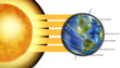 Diagram of five major circles of latitude on the Earth. Vector illustration
#119735692
 earth
earth
#113061687
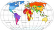
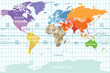 political map of the world with all continents separated by color, labeled countries and oceans, and...
#12358340
 Map of world
#506812220
 Earth planet vital areas infographic diagram angle of sun ray sunlight radiation solar wind concept...
#472772985
 Ecuador, Cayambe true equator site
#81988225
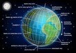
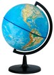 Globe.
#437623125
 The equator line building monument in Mitad del Mundo (Middle of the World), Quito, Ecuador.
#531952794
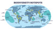 Biodiversity hotspots with life species variety on world map outline diagram. Labeled educational...
#680240563
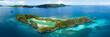 Idyllic Rufas Island, near Penemu in Raja Ampat, is surrounded by healthy corals and open ocean....
#56944378
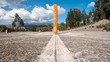 Equator Line Monument, marks the point through which the equator
#666459615
 Globe with North America Isolated on Transparent or White Background, PNG
#519389841
 The World, important circles of latitudes and longitudes, blue colored political map. Equator,...
#603766011
 3D Isometric Flat Vector Conceptual Illustration of Latitude And Longitude Diagram, Geographic...
#408150065
 Ecuador. Parque Nacional de las Islas Galapagos. Pingüinos de Galapagos (Spheniscus mendiculus) y...
#78022037
 Middle of the World monument, quito, Ecuador
#458132061
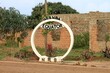 sign of equator Line in Uganda
#507699103
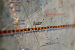
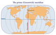 Map with the Greenwich prime meridian
#108226879
 World map infographic template. All countries are selectable
add to favorites