

Selfadhesive vinyl solomon islands, solomon islands on film, solomon islands on adhesive film
FILTER RESULTS
Image orientation: all
horizontal
vertical
square
Filetype: all
photo
illustration
vector
Apply
#83135654
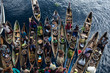 Floating Market in Dugout Canoes
#442438306
 Ships and boats anchored in Honiara harbour, Solomon Islands.
#284426825
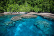
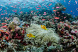 South Pacific, Solomon Islands. Reef of fish and corals. Credit as: Jones & Shimlock / Jaynes...
#244748906
 Tropical island Solomon island
#116529927
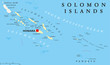 Solomon Islands political map with capital Honiara on Guadalcanal. Sovereign country consisting of...
#90966339
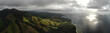
 Solomon Islands Aerial View
#176004183
 Solomon Islands, tropical water
#289619482
 created by dji camera
#475484622
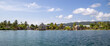 Waterfront houses in a village in Marovo Lagoon of the Solomon Islands.
#358092207
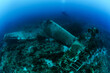
 The diver admires the delicacy of the coral that rests on the wall. Munda (Solomon Islands)
#681718559
 Solomon islands highly detailed political map
#701211742
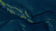 Solomon Islands outlined. High-res satellite map
#258815660
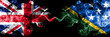 United Kingdom vs Solomon Islands smoky mystic flags placed side by side. Thick colored silky smoke...
#388311619
 A fish in his habitat
#8914949
 3d rendered and waving flag of solomon islands
#284428417
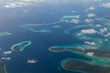
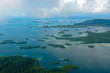 Aerial of the Marovo Lagoon, Solomon Islands, Pacific
#353075322
 Sights Of Sydney. Ship-forest
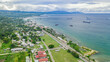
#317612004
 View of Honiara, Guadalcanal Island, Solomon Islands
#608172543
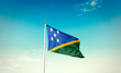 Waving Flag of Solomon Islands in Blue Sky. The symbol of the state on wavy cotton fabric.
#534247869
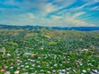 Aerial of houses and nature with the background of mountains in East Honiara, Solomon Islands
#81740470
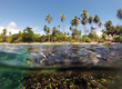
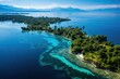
 Tropical Island and Coral Reef
#438285406
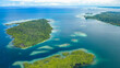 Islands and the surrounding reefs in the South-east of Choiseul island, Solomon Islands.
#381584097
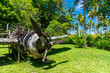 wildcat wreck
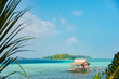
#244723398
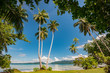 Tropical beach Uepi island
#661788349
 Hellcat Aircraft Wreck
#111813403
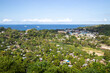
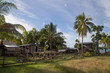 Local village on the Solomon Islands
#626992933
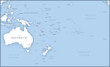 Map of Australia and Oceania with names of countries, capitals and cities.
#377631060
 Solomon Islands flag isolated on white banner
#475479775
 Chinatown and Iron Bottom Sound from Skyline Ridge in Honiara, Solomon Islands.
#360894451
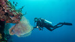
 The silhouette of the diver is tiny next to the giant gorgonia. Munda. (Solomon Islands)
#685168829
 Solomon islands landscape. Aerial drone view. Generative AI Art. Beautiful view.
#698581815
 Solomon Islands highlighted. Low-res satellite map
add to favorites