

north america on dibond, aluminum dibond north america, north america dibond plate, north america on aluminium
FILTER RESULTS
Image orientation: all
horizontal
vertical
square
Filetype: all
photo
illustration
vector
Apply
#389421653
 North America map templates. USA, Canada and Mexico map isolated on white background. North America...
#116779441
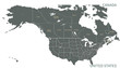
 North America with countries Map grey
#120847083
 Map of North america
#339676659
 Earth at night from outer space with city lights on North America continent. 3D rendering...
#148092106
 North America map vector illustration, scribble sketch North America
#292684540
 map of North America
#183073718
 United States of America lights during night as it looks like from space. Elements of this image are...
#316397184
 North American continent with contours of countries. Vector drawing
#289276520
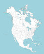
 High quality map of North America
#371341983
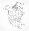
 North American Countries Map.
The main boundary map of Canada, the United States.
North American Countries Map.
The main boundary map of Canada, the United States.
#546577296
 Black colored North America outline map. Political north american map. Vector illustration map.
#222932662
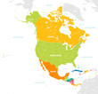 Colorful Vector map of North and Central America
#457282126
 Map of North America, isolated on white background. Vector EPS.10
#7027691
 North America vector map with countries
#455546121
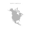 Square dots pattern map of North America. Dotted pixel map. Vector illustration
#200621234
 North America map vector icon. Flat design blue color
#664031957
 USA from space at night with city lights
#83019643
 Infographics Vector Background #Global Map_North America
#192751815
 Earth from space North America
#126422103
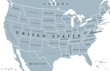 USA United States of America political map with capital Washington, single states, neighbor...
#241560584
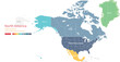
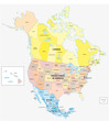 Administrative and political vector map of the three North American states, Mexico, Canada and the...
#159611391
 North America. Earth globe. Global business marketing concept. Dotted style. Design for education,...
#186759403
 Map of North America
#422594376
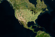
 Sun shining over a high detailed view of Planet Earth, focused on North America, USA and Canada. 3D...
#243840418
 Satellite image of USA with borders and state lines (Isolated imagery of USA. Elements of this image...
#298232404
 map of North America
#258993093
 3D Earth illustration zoomed on North America
#245810417
 North American continent with contours of countries. Vector drawing
#286722141
 Telecommunication network above North America and United States viewed from space for American 5g...
#377805267
 Colorful detailed vector map of the north American country.
#305037349
 North America with country borders, vector illustration.
#212240928
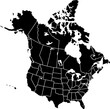
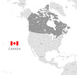 Grey Vector Political Map of Canada
add to favorites